


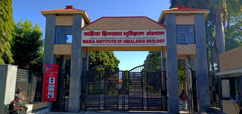
 The Wadia Institute of Himalayan Geology (WIHG) at Dehradun has acquired a significant place in the national and global community exploring earth science aspects of the Himalaya. The sui generis nature of this institute possesses nearly all state-of-the-art earth sciences equipment under one roof that provides flawless data to whole geosciences academia nationwide on a range of areas like settling the stratigraphy of Himalaya, landslide and flood hazards, river landscape of Himalayas, as well as the seismic network.
The age of the Lesser Himalayan rock was a hot debate amongst the geoscientists and considered to be Upper Palaeozoic (~570-500 million years ago). The year 1983 dawned with WIHG putting to rest all controversies. Abundant, index conodont fossils were discovered from the Tal rocks which fixed the age as Late Precambrian (4600-540 mya) to Cambrian (540-485 mya). The subsequent discovery of acritarchs and microfossils of Ediacaran age from Infra Krol and Krol A rocks confirmed this changing the chronology of rock superposition in Himalaya and shifting the global biotic correlations and configuration continental assembly of Gondwana land.
Striving to understand how the geology of Himalaya and rainfall distribution play an important role in identifying hotspots of mass wasting, the institute has played a leading role in treating chronic landslide at Varunavat in Uttarkashi. Landslide hazards zonation has been delineated in Itanagar Capital Complex.
Having developed new tools for mapping and understanding large floods and their impact on the Landscape of Himalaya, which are vulnerable to the society, WIHG played a pivotal role in helping understand the devastating 2013 Kedarnath floods under the “Mapping the Neighbourhood in Uttarakhand (MANU)” initiative of DST and helped in preparing a guideline on alleviating societal vulnerabilities during large floods.
 The institute has produced the largest database on the chronology, sedimentary architecture, and landscape evolution of rivers Indus, the Ganga, the Brahmaputra and tributaries in the Himalaya. A study comprising details on the Indus, the Ganga, the Brahmaputra and their tributaries flowing across full climatic and tectonic spectrum of Himalaya established the concept of climate change leading to river erosion and formation of terraces with known hotspots of deposition, has been globally accepted.
WIHG established a seismic network in 2005 to monitor the seismicity pattern of the central seismic gap comprising the regions of Garhwal, Kumaun, and Himachal Himalaya recording observations which have gone a long way to assess earthquake and landslide risk in these areas. Further, exploring deep earth structures of the crust and lithosphere below the Himalaya has also been frontline research of WIHG leading to passive seismological studies that defined the geometry of the Main Himalayan Thrust (MHT) and identified seismically active areas and the propensity of other areas to such activity.
These reflect the tip of the iceberg of the achievements of this institute at Dehradun, an autonomous institute of the Department of Science & Technology (DST) which has been pursuing basic and applied research to unravel the orogeny of the majestic Himalaya for improved understanding on sciences (geodynamics, seismogenesis, climate-tectonic interactions, evolution and extinction of life) and providing implications for society (natural hazards due to earthquakes, landslides, floods etc., natural resources (glaciers, river and spring waters, geothermal, hydrocarbons, minerals and precious ores, anthropogenic influence etc.). It is driven by the vision -- ‘Questing for Himalayan Seismogenesis, Geodynamics, Natural Hazards, Climate Variability and Natural Resources through Geoscientific study to fulfil the Societal Needs and pursue Basic Sciences’.
The research activities in understanding the mountain-building processes and its impacts to the surface and subsurface processes to address the above are based on observations made by several branches of geosciences: structural geology, petrology, paleontology, stratigraphy, sedimentology, geomorphology, passive & active seismology, geophysics, remote sensing, engineering geology and so on. Special emphasis has been laid on providing implications of upstream climate change on the Himalayan glaciers and their consequences to the downstream river system, which is the lifeline of tens of millions in the plain. The study of slope instability for landslides, and flash floods, and lake-outburst floods are other important areas of research.
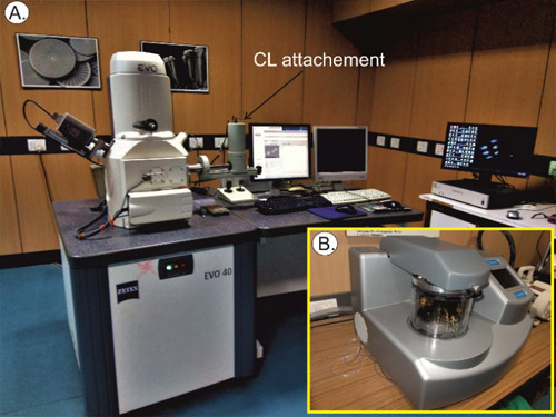
The WIHG is well equipped with sophisticated analytical instruments. The facilities are being utilized not only by the research scientists of WIHG but also by the researchers of the state & central universities, other institutes, and organizations.
")


")


