


Experts discussed how the Integrated Geospatial Information Framework (IGIF), which provide a basis for developing, integrating, strengthening, and maximizing geospatial information management in all countries, could help supporting sustainable development and the well-being of society as well as overcoming challenges of the global village like flood, earthquake, pandemic, energy, digital security and so on at the 2nd UN World Geospatial Information Congress (UNWGIC 2022).
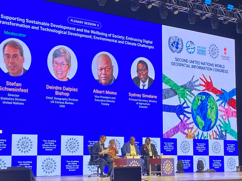
Stefan Schweinfest, Director, Statistics Division, United Nations, highlighted the need for participation from the government, private sector, data producer, and data user, as well as social and environmental perspectives from developed and underdeveloped countries for successful implementation of the framework, at a plenary session of UNWGIC.
“There are three main components of the IGIF- overarching strategies, implementation guide, and country level action plan, to strengthen geospatial information management to deliver sustainable social, economic and environmental development for a better future,” Deirdre Dalpiaz Bishop, Chief, Geography Division, US Census Bureau, USA pointed out.
“We are more physically and digitally connected than ever, and there is a need to collaborate for improved geospatial data, innovation, education and communication, and engagement from all countries for implementing IGIF in tackling global challenges, as a major disaster in one country impacts adjacent countries,” she added.
Albert Momo, Vice President and Executive Director, Trimble, an industrial technology company, emphasised the role of geospatial technology in digital transformation. “It can alter sensing, modeling, analytics as also the work of geospatial professionals, agriculture planning, heavy civil construction, building design, construction and operation, transportation and logistics, water and wastewater utilities, electricity utilities, field services, and government. Our goal is to enable a sustainable future for better world," he elaborated.
Sydney Simelane, Principal Secretary, Ministry of Agriculture, Eswatini, underlined the need for availability of geospatial information to implement climate change mitigation and adaption, especially in small countries like Eswatini. “We also need legal frameworks for safeguarding the availability and usage of geospatial information and institutional frameworks to ensure data standards, interoperability, and accessibility. All policies, strategies, and action plans for tackling climate and other environmental changes are in vain without geospatial information because these occurrences take place somewhere,” Sydney pointed out.
During the 2nd UNWGIC, a report on “Indian experience in alignment with IGIF was unveiled by Union Minister for Science and Technology and Earth Sciences, Dr Jitendra Singh. Based on this experience India is also bidding for the chairmanship of the newly constituted Working Group on IGIF under the UNGGIM-AP (Asia Pacific).
The five-day conference is being hosted by the Department of Science & Technology (DST) and convened by the United Nations Committee of Experts on Global Geospatial Information Management. With the theme of ‘Geo-Enabling the Global Village: No one should be left behind,’ the Second UNWGIC 2022 reflects on the importance of integrated geospatial information infrastructure and knowledge services to support the implementation and monitoring of sustainable development goals.
")


")


